Crowdsourced Bathymetry
Data Collection, Processing and Distribution
Vessel Engagement Data Harvesting Data Distribution
The Challenge
Approximately 23% of the world’s oceans and only 15% of the Great Lakes have been mapped with modern bathymetric survey technology and to current data standards.
Numerous projects, including those sponsored by The Nippon Foundation-GEBCO, Map the Gaps and Great Lakes Observing System [GLOS] are underway worldwide to increase the available data and close the gap in order to have 100% of the oceans and Great Lakes mapped by 2030.
Engaging Vessels
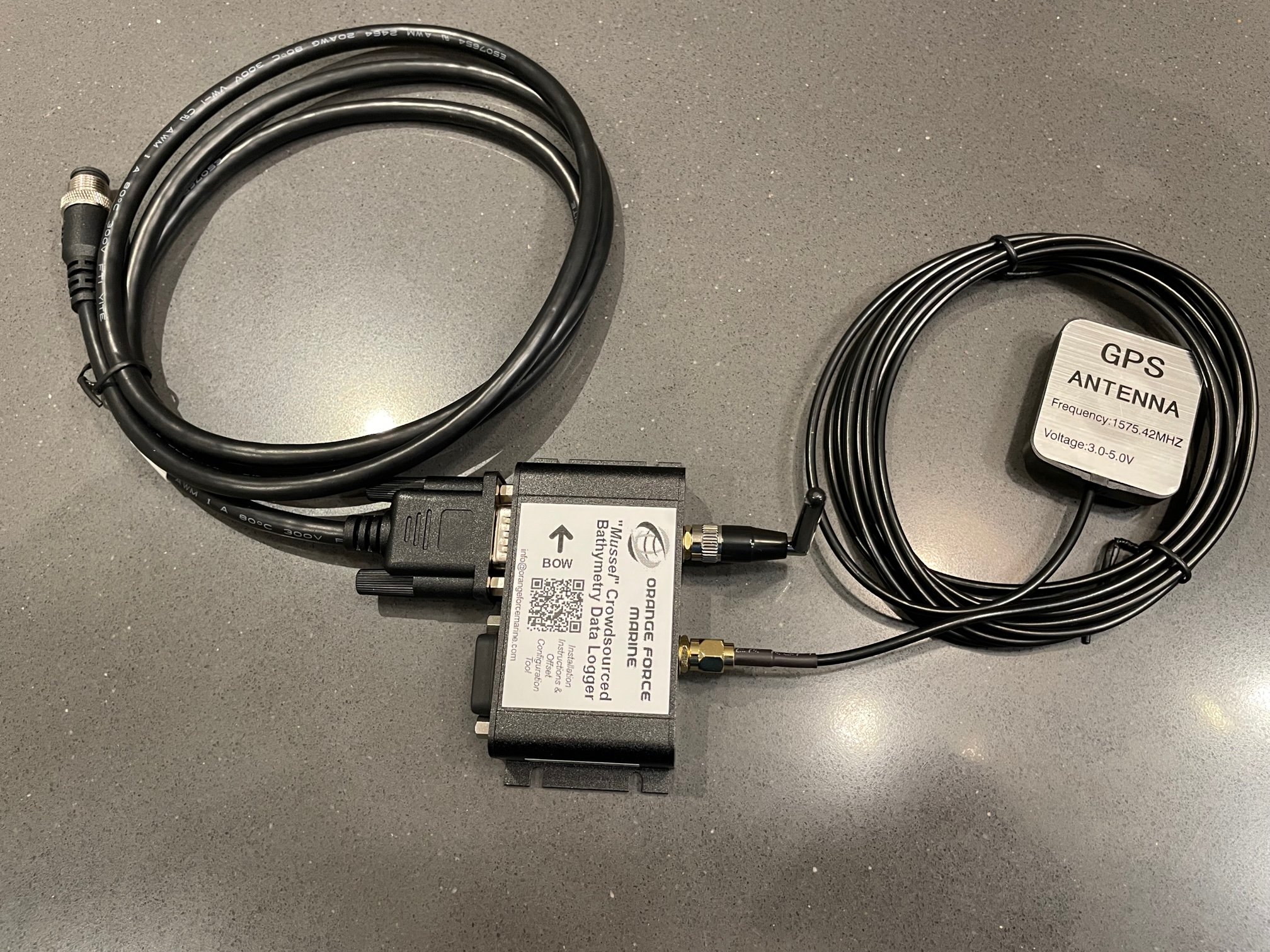
Any vessel with current navigation and depth sounding equipment can participate in our Crowdsourced Bathymetry (CSB) initiative. Orange Force Marine’s (OFM) “Mussel” kits are industry proven and via a robust, non-intrusive, seamless hardware installation, data is transferred to the cloud without operator intervention.
Participating vessels may range from recreational sail or power boats, rescue vessels, government research, small and large commercial, fishing to large carriers.
Vessels contributing to citizen science are able to assist in this valiant goal of bathymetric mapping our waters. There are no costs borne by the vessel owners as OFM will facilitate and manage the fleet of “Mussel” kits across all sponsoring organizations.
Harvesting data via the Automated Pipeline
Secure vessel-to-shore communications are handled via Wi-Fi, via current ship communication systems, or via cellular or satellite provider solutions.
Once in the “Harvesting Center,” data is decoded, processed to select data elements, and converted to necessary formats for storage, visualization and analysis. Pending the accuracy of shipboard sensors, data quality may be validated to meet the IHO Order 1A standard.
Data is automatically transferred to the International Hydrographic Organization (IHO) CSB database by way of a Trusted Node. Sponsoring organizations can also receive their data collected for their scientific or management purposes in standard industry formats (XYZ or GSF-generic sensor format).
Click on the image below to see examples of our collected data:
OFM is constantly evolving the data harvesting pipeline to demonstrate “Fully automated, near real-time bathymetric and vessel instrumentation data acquisition with processing and customized distribution via the cloud.” The ping to cloud concept, provides clients with the best solution to meet their operations, within their environment and facilitate the intended use of the resulting datasets by themselves or their partners.
Various loggers, including our “Mussel” kit, can provide the necessary data acquisition while the distribution of the resulting processed data formats and destinations can be controlled and customized by the customer.
Offer your Vessels or Become a Sponsoring organization
Scientific, Academic, Government, commercial organizations or private entities may contribute through one of many sponsorship plans via the Not-for-Profit organizations such as GLOS, Map the Gaps or Seabed 2030.
With financial support from sponsors, in support of the Lakebed 2030 & Seabed 2030 initiatives, OFM manages the fleet of participating vessels, maintains the “Mussel” system infrastructure and delivers the complete data pipeline from the vessel all the way to the IHO Data Center.
If you are interested in sponsoring a CSB program or operate a vessel or fleet of vessels and would like to have a “Mussel” CSB kit installed onboard to take part in this exciting mapping initiative, please contact us to further explore how to join in!